SURVEYING
Services Offered
- Topographic (GPS, Total Station)
- LiDAR + 3D Mapping
- Bathymetric
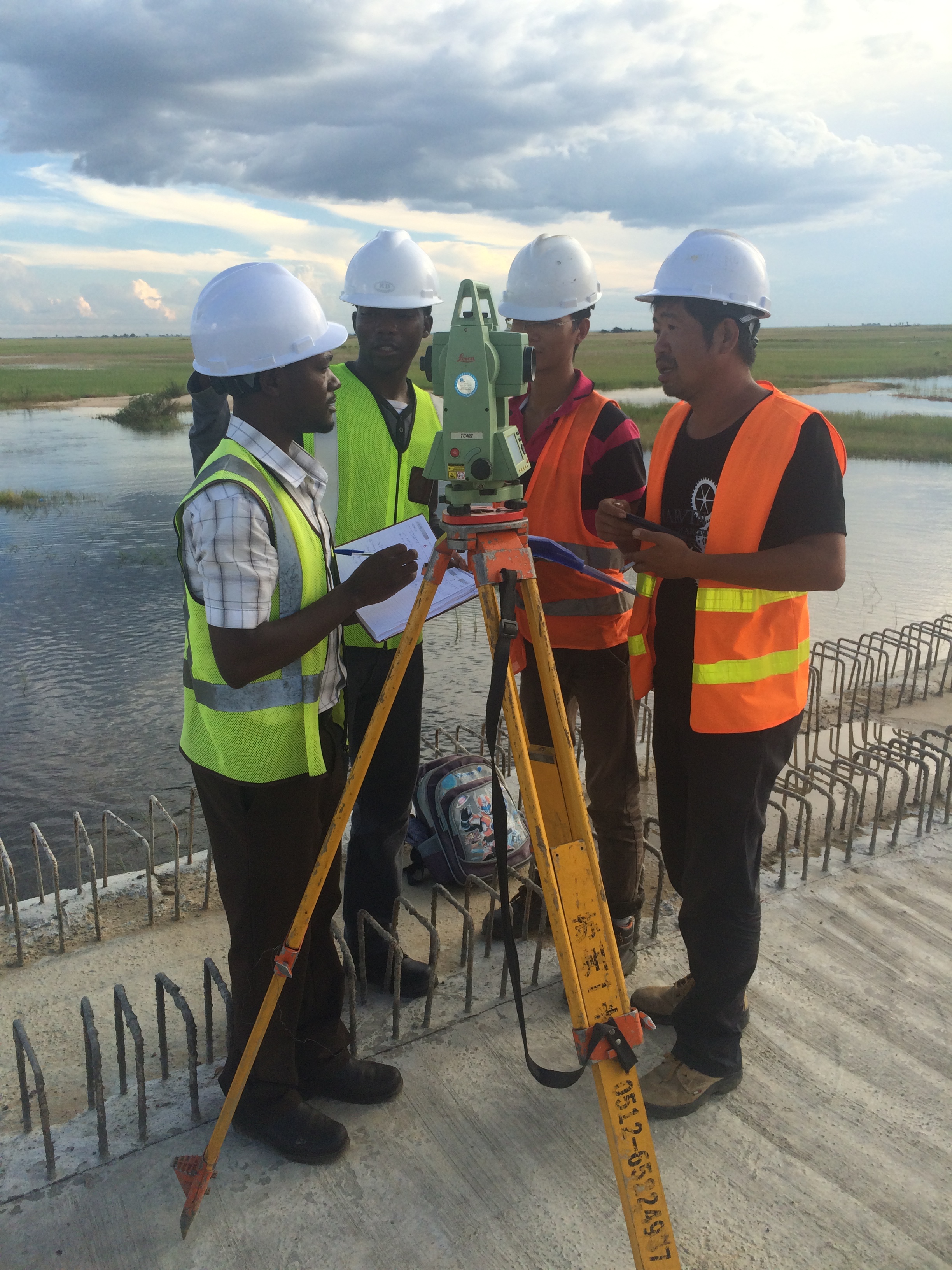
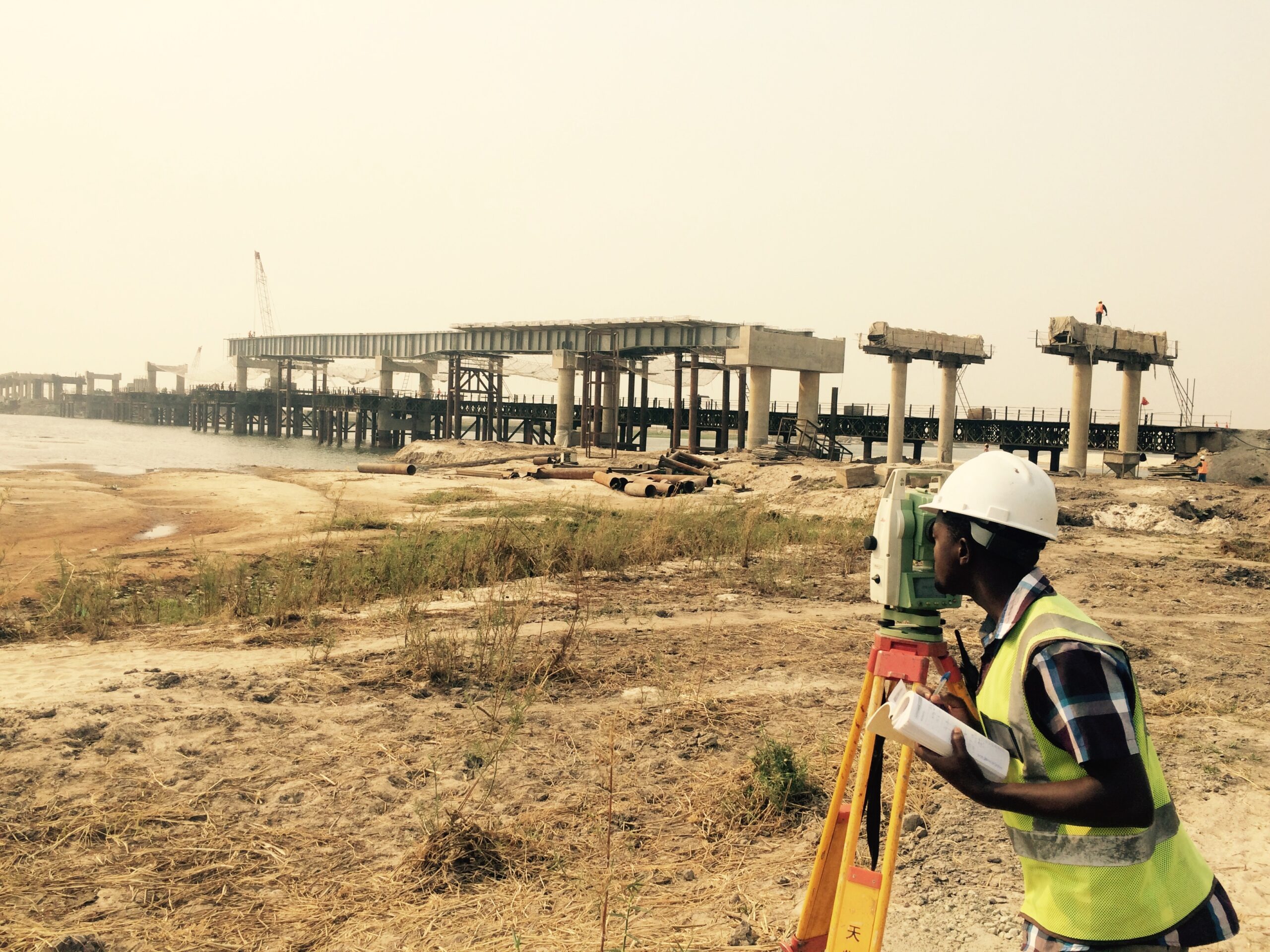
Widely used by professionals in the design and rehabilitation of infrastructure across the globe, topographic surveys are a fundamental part of reducing the risk of mistakes at the design and planning stage of a project.
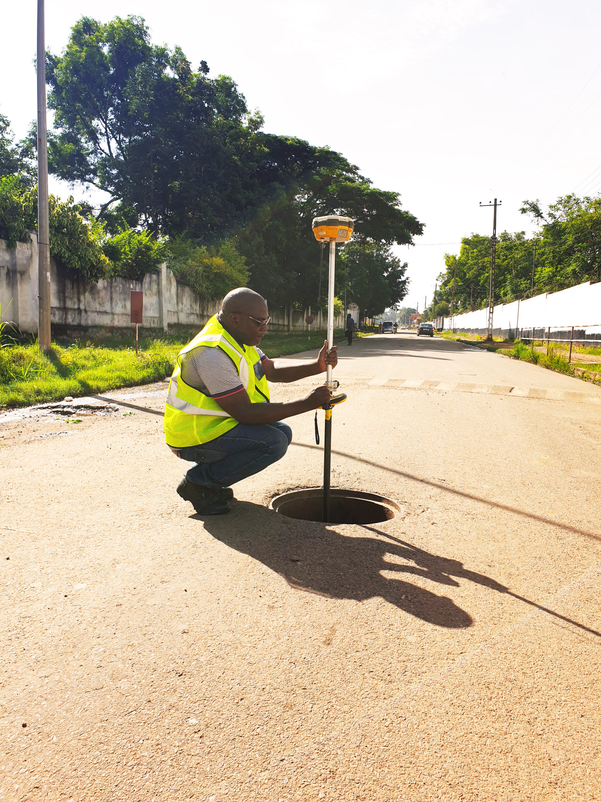
Rankin takes full advantage of its own equipment to carry out topographic surveys for clients on a wide range of projects. Where required, this data can be further engineered using the full range of software which allows for road, water reticulation, sewer reticulation and electrical systems design.
Rankin owns and operates Global Positioning System (GPS) surveying equipment while ensuring level control is achieved accurately by use of Total Stations and Digital Levels. All equipment are compatible and can be interchanged with the hand-held loggers deployed, enabling rapid collection of data, for further processing by the design team.
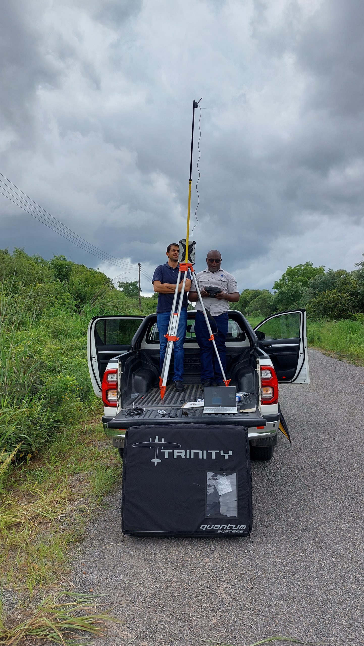
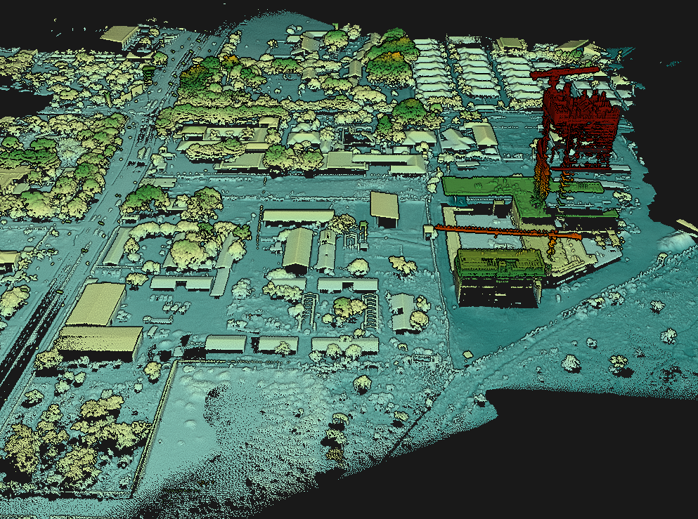
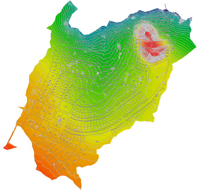
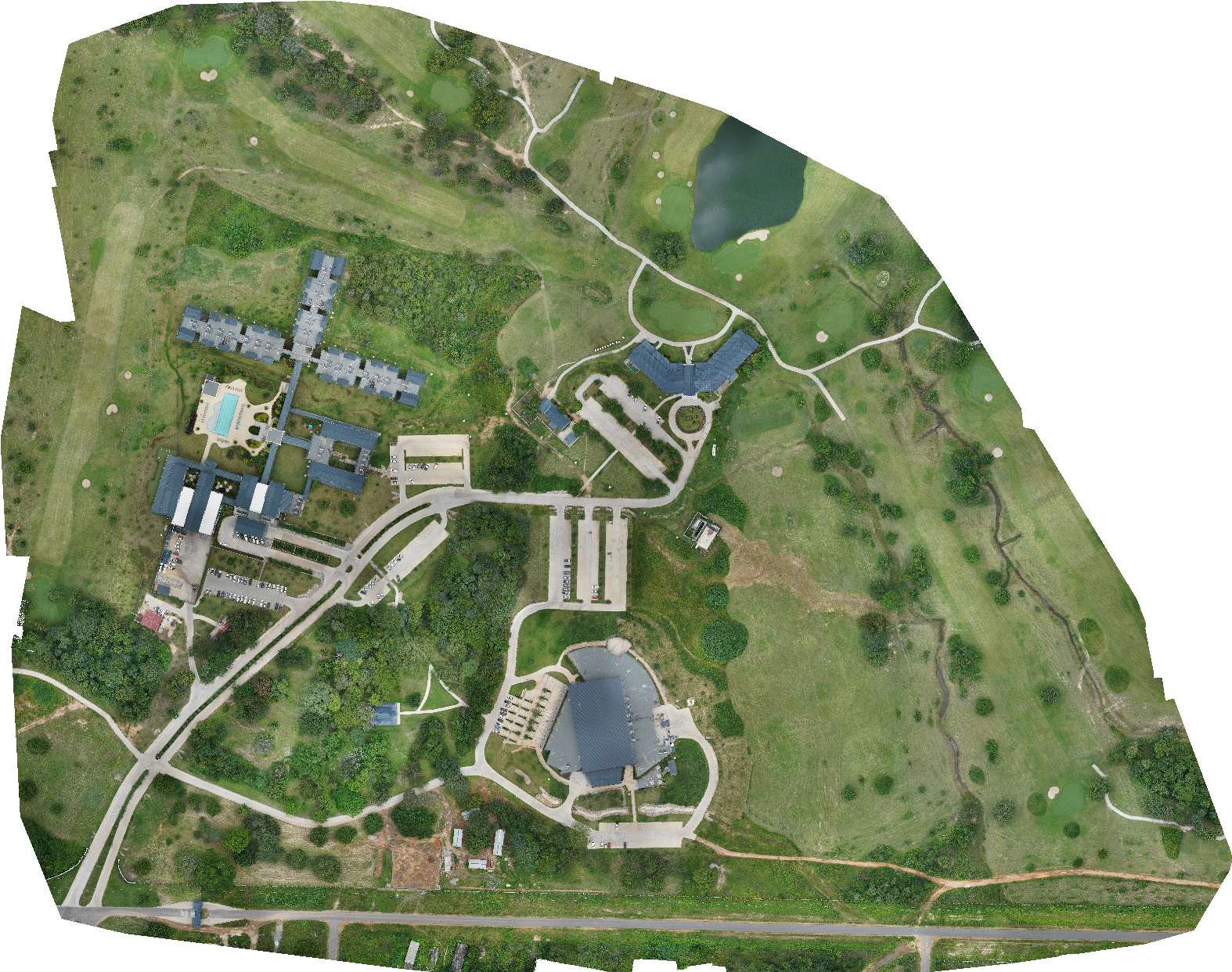
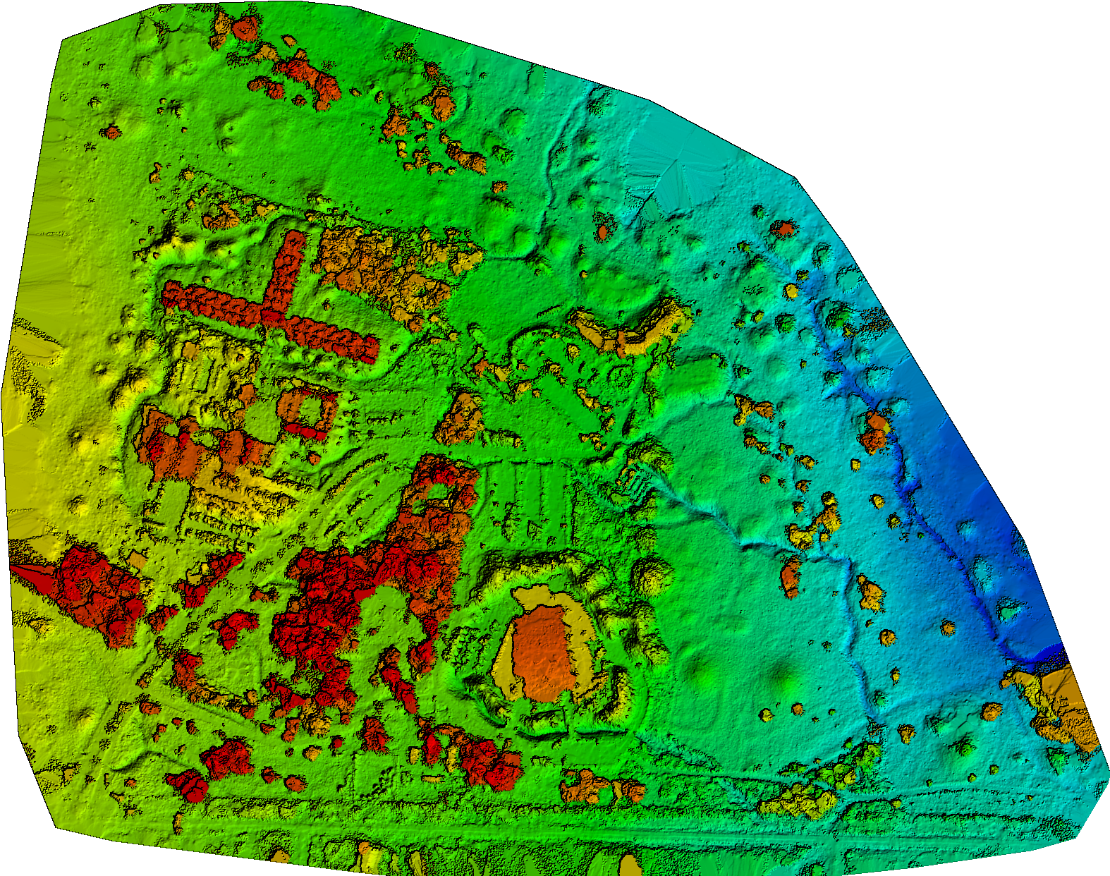
Rankin can now offer 3D Photo Mapping and Lidar Surveys using its own state of the art fixed wing drone. We offer full post processing and analysis of the data as well as Point Clouds, Digital Terrain Models, Slope Analysis, Drainage etc.
Surveying works have been carried out for a wide array of projects including road and bridge infrastructure, hydropower and transmission line design, water and sewer reticulation design, agricultural and commercial development works, mining and related industry as well as for flood control. Combining sonar and surveying equipment, Rankin is also able to carry out accurate bathymetric surveys, critical to the development of bridge, port and dam design works.